Sat Aug 08, 2020 12 Projections for 2020 (Part 8)
To understand what this is about, you should read the intro.
August: Hölzel Projection
| Hölzel | |
|---|---|
| Creator | Unknown (1950 approx.) |
| Group | Pseudocylindric |
| Property | Compromise |
| Other Names | — |
| Remarks | Named after the austrian publishing company Hölzel who used the projection in their atlases. The creator is unknown to me. Projection is based on Eckert V. |
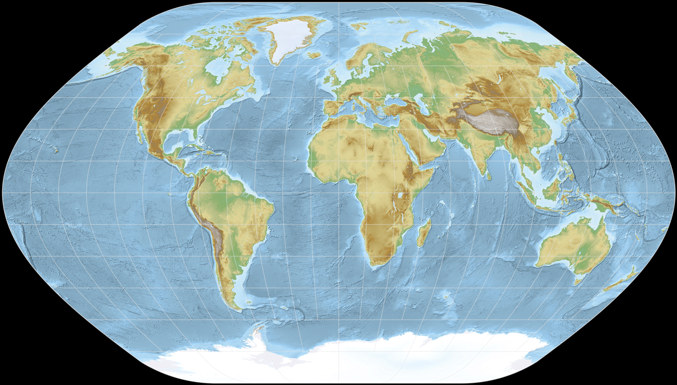
This month, we’ve got a projection which doesn’t look unusual – I guess to most people, it just looks like a world map has to look – but actually is unusual because it is rarely used. With one exception:
It is the Hölzel projection which was created in the 1950ies to be used in the Austrian Hölzel atlas, and there it is used to this day
as you can see in the digital preview of the atlas
[Update Nov. 2022: Regrettably, the preview isn’t available anymore].
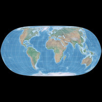
It’s a pseudocylindric projection with equally spaced parallels which was mathematically derived from Eckert V.
It was compressed horizontally – Eckert V has an aspect ratio of 1:2 while it’s roughly 1:1.75 on the Hölzel –, among other things
this leads to the fact that it fits the spread of the atlas better, leaving just enough space for a few legends without wasting
too much space.
I don’t know if that was the reason for this modification, it’s
also quite possible that it was about the distribution of angular distortion, which turns out to be somewhat advantageous
for the inhibited areas of the Earth on the Hölzel:
Of course, you can get very similar distortions in the Eckert V by simply stretching it
vertically by a factor of about 1.1 – but the Hölzel introduces another modification, namely
the rounded corners which have a more “organic” appearance and thus, may regarded as a bit more
“friendly”.
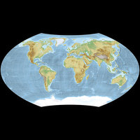
Compare the Hölzel projection and Eckert V directly.
All in all, the Hölzel projection is, in my opinion, a good pick if you want or need a pseudocylindric projection with equally spaced parallels (although I won’t deny that this is not my favorite kind of projection).
Next month, we’ll have an equal-area projection that looks unusual and is unusual, because I’m pretty sure it has never been used anywhere.
The image was created with SimpleDEMViewer using ETOPO1 elevation data. Projected to Hölzel with Geocart. The color set is based on the Maps template by Eric Gaba, username Sting.
My 2020 Map Projection Calendar
To read another part of my 2020 map projection calendar series, select the desired month.


 Except where otherwise noted, images on this site are licensed under
Comments
Be the first one to write a comment!