
Mon Mar 13, 2023 13 Projections for 2023 (Part 3)
A collection of projections for political world maps
(see Intro for further explanations)
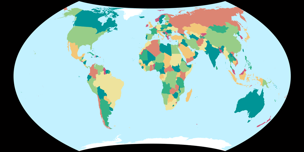
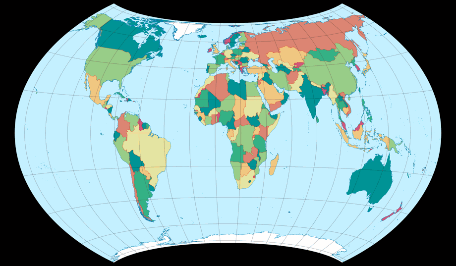
March: Wagner VII

| Wagner VII | |
|---|---|
| Creator | Karlheinz Wagner (1941) |
| Group | Lenticular |
| Property | Equal-area |
| Other Names |
|
If you want or need an equal-area political world map that doesn’t look out of the ordinary,
there’s hardly a better choice than the Wagner VII.
Period!
No “in my opinion” here, because that’s just a matter of fact.
Bye, see you next month!
😉
… alright, alright, maybe it is my opinion.
However, it is such a settled opinion that I will not believe anything else, even if it is proved to me. But which
Wagner VII is it I’m talking about? Basically, about the famous one, which is usually referred to
when somebody says “Wagner VII” or “Hammer-Wagner”, which is determined by the Böhm notation[1] 65-60-60-0-200. Nonetheless, Wagner’s other variants of 1941, that I have labelled
Wagner VII.b, VII.c and VII.d, also work fine for a political map.
I would probably use the 1971 version (VII.e) as the last of the five for this purpose –
amazingly, it is the only variant I have actually seen in an atlas (apart from the famous one).


It is sometimes said that world maps should be equal-area for reasons of equitability. I don’t fully agree to this statement: An equal-area projection will always have a comparatively high amount of angular deformation. Isn’t that also a kind of inequity?
But nonetheless, I like equal-area world maps! I like to be able to compare countries’ sizes (even although I’m aware that this can only be done approximately by eye anyway). So I’d like to see equal-area political maps more often, in atlases and on wall maps. For this purpose, however, it is rather the compromise projections that have established themselves, hence most of the projections of this year’s calendar also belong to this class.
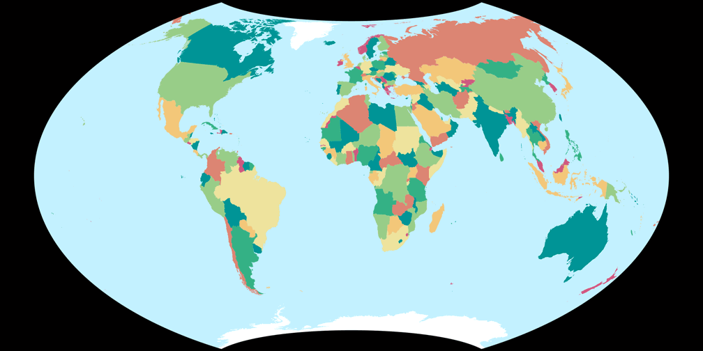
Back to our “March-projection”! With its curved meridians and parallels, it does not seem predestined for the OGABO version. But – actually I think the map looks quite workable. As for the plagal aspect, most of the land masses look good, but South America (and Antarctica) get distorted badly.


Did you notice that above, I wrote there’s hardly a better choice than Wagner VII? So there is a better choice after all? Yes, sort of, and no, not really …
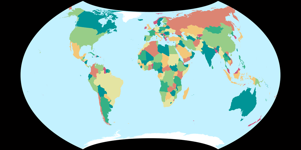
Wagner VII vs. Frančula XIV
Frančula XIV[2] is a projection which in my opinion is an even better choice
for political maps, but actually it isn’t a different projection.
It’s a Wagner VII variant (Böhm notation 59-80-60-0-194), optimized for low
distortions according to the Airy-Kavraiskiy criterion.
Let’s compare the two, and for once[3] right here on the blog:
Wagner VII (65-60-60-0-200)

Frančula XIV (59-80-60-0-194)
If you only look at the “skeleton” of the projections, the outer appearance – meaning the aspect ratio of the main axes, the length of the pole line, the moderate curvature of the parallels – I prefer Wagner VII. On the other hand, if we look at the visualisation of the angular distortions, I see clear advantages of the Frančula XIV:
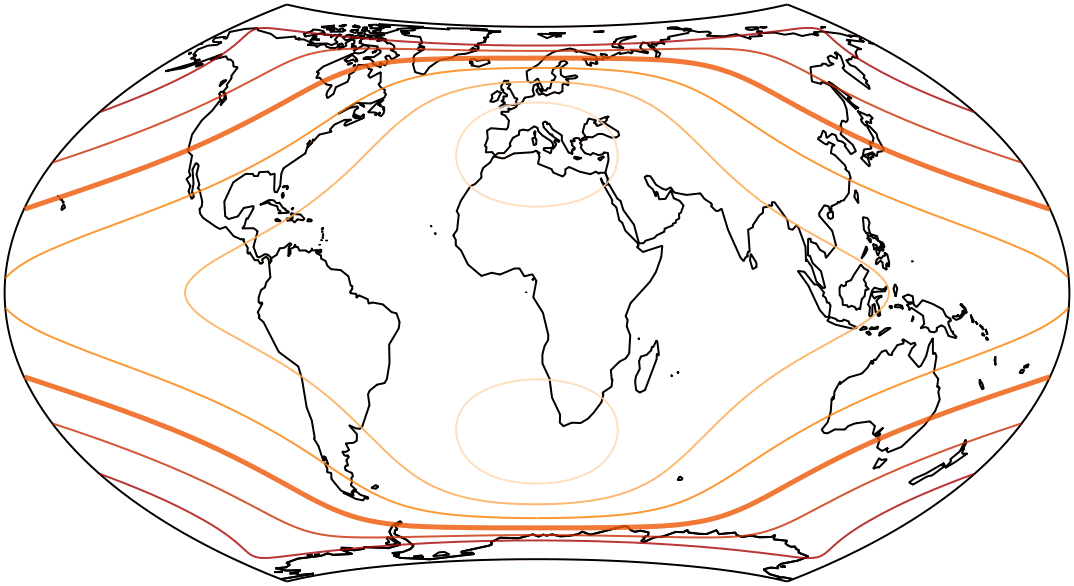
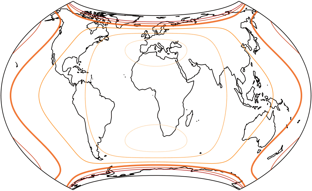
The isolines are given for max. angular deformation of:
10°, 20°, 30°, 40°, 50°, and 60°.
Remember that I was going to talk about Pacific-centered maps again in the January part of the calendar,
but then postponed it to the February part, and then to March?
I think this should be a running gag. Each month it’ll be postponed, and in the end,
i.e. the December part, there will be two sentences regarding this matter, and that’s it.
No, seriously: I’ve postponed this so often now that it doesn’t matter any more.
And it also fits better with the April projection, so … so long!
References / Footnotes
- ↑ For more information about “Umbeziffern”, Wagner’s transformation method and the Böhm notation, read Das Umbeziffern – The Wagner Transformation Method, or the brief explanation in this blogpost or the notes at the Wagner Variations Generator (WVG-7).
- ↑ Created by Nedjeljko Frančula in 1971. See my blogpost The Frančula Projections.
- ↑ Usually, I’d just send you over to the comparison in my Projection Collection – after all, comparing map projections was the original idea of this website.
My 2023 Map Projection Calendar
To read another part of my 2023 map projection calendar series, select the desired month.


 Except where otherwise noted, images on this site are licensed under
Comments
Due to spam posts, comments are now subject to moderation, which means they remain hidden until they are approved by a moderator.
More info
Be the first one to write a comment!